July 2023, La Sierra Madre Oriental, Meztitlán, Hidalgo, Mexico
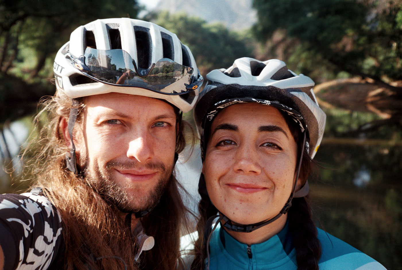
It is July in Mexico, and my partner Poli and I are taking the first steps towards learning more about La Sierra Madre Oriental, specifically, La Sierra de Hidalgo.
Like many things here, word of mouth is the best source of information regarding routes, conditions, and most importantly: safety. There is very little documentation in general, and often times, maps of la sierra and volcanos don’t show caminos connecting, or even existing at all.
Finding thorough information is an adventure in in itself, especially en La Sierra. A fragmented web of circles: local riders young and old, a mix of cycling clubs, and señoras y señores de los pueblos you travel through. It’s a game of finding out who has passed through before (or not), digging through heatmaps, existing GPS tracks, and a lot of satellite view.
GPX Link
_
Mexico City
Before jumping into this recap, i’d like to share some light background and geographical context on the starting point for most adventures these days: Mexico City, once home to the ancient Aztec city of Tenochtitlán.
The Valley of Mexico sits at 7,350ft or 2240masl, which is exceptionally high for a valley. The city itself is completely encompassed by the Eje Volcánico Transversal (Trans-Mexican Volcanic Belt) an enourmous zone with blisteringly tall Volcanos and Peaks.
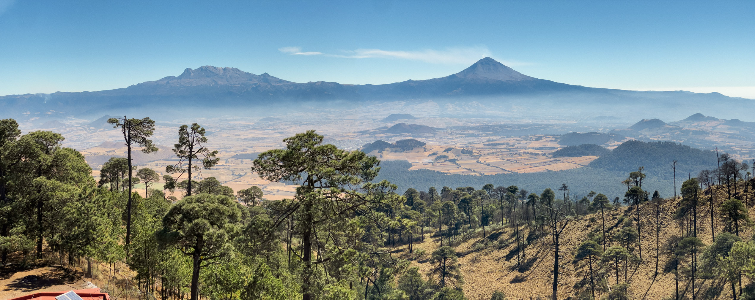
Visible from the city on clear days are Iztaccíhuatl y Popocatepetl, enormous Volcanes with elevations of 17,159ft and 17,694ft respectively. Mexico has a very high concentration of Sierra, including the Eje Volcánico. In fact, half of the national territory is mountainous region [scielo].
The valley of Mexico itself is quite large and mostly flat, scattered with cerros and inactive volcano cones. This high valley is historically fertile and has a deep history of ancient civilizations in Mesoamerica. It sees significant rain in the summer months, with a dry, hot season spanning the other half of the year. To the south, over the Volcanos, you drop far below the valley of Mexico into the state of Morelos. Over the mountains to the the east is an even higher valley, Toluca, at 8,790ft or 2,680m.
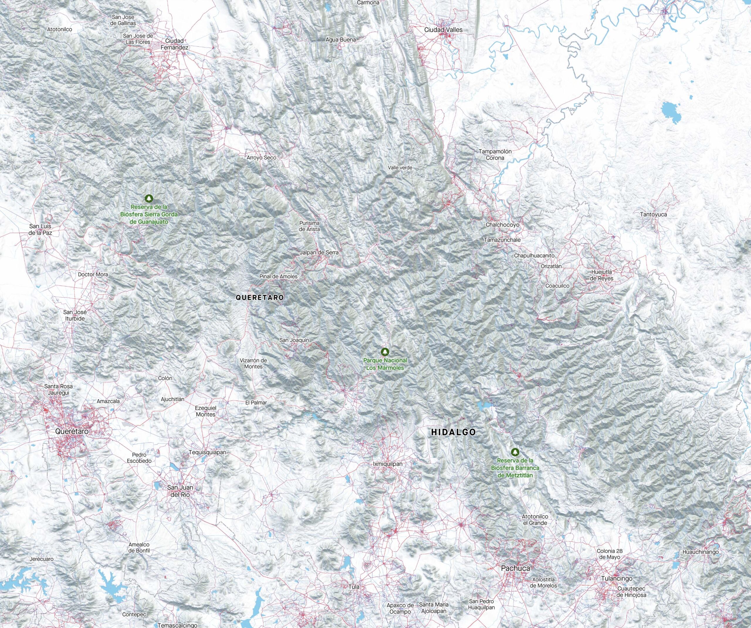
Heading north, the flats eventually end, and you’ve arrived en La Sierra Madre Oriental. Spanning across numerous states from northern Puebla, Hidalgo, Querétaro, and San Luis Potosí.. all the way to Coahuila and the US border at the Rio Grande. One of three La Sierra in general is HOT with very rugged, wild terrain.
_
La Sierra Madre Oriental
The main goal of this small trip was to figure out a good starting place for a longer expedition to cross La Sierra northbound. I am building a route to cross La Sierra Madre Oriental and have been studying the maps for some time now, which is almost dizzying its so complex.
It is extremely important to consider Ejidos and what the rules are. Communities can be very protective of land in Mexico, you have to speak with locals to see what is ok. An Ejido is basically a cooperative of people who own the land and govern themselves. In Mexico, Ejidos control land, not always municipalities, especially in rural and wild areas.
The mission to build routes here becomes an evolving game of trial and error and learning as you go. These tend to be my favorite type of bike rides 🙂 …Although in la Sierra, the stakes are quite high: Limited resupply, debilitating heat, and a dash of uncertainty for how far you can make it – or if you’ll have to turn around. Open mind!
With any adventure here in Mexico, we speak with locals who know the area best, may have passed through the area, or know someone who might have. In this case, only a couple friends had ever been to where we were going.
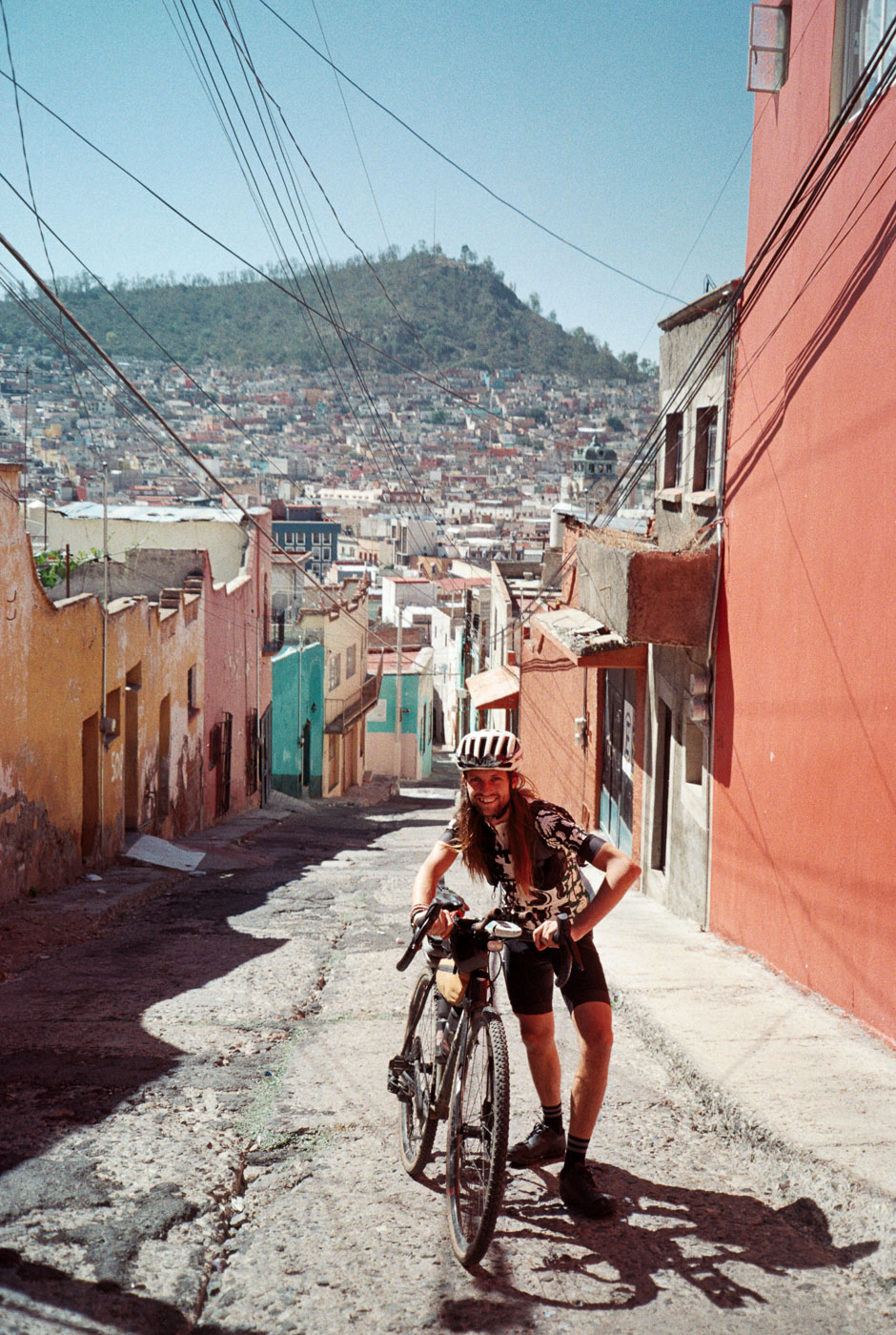
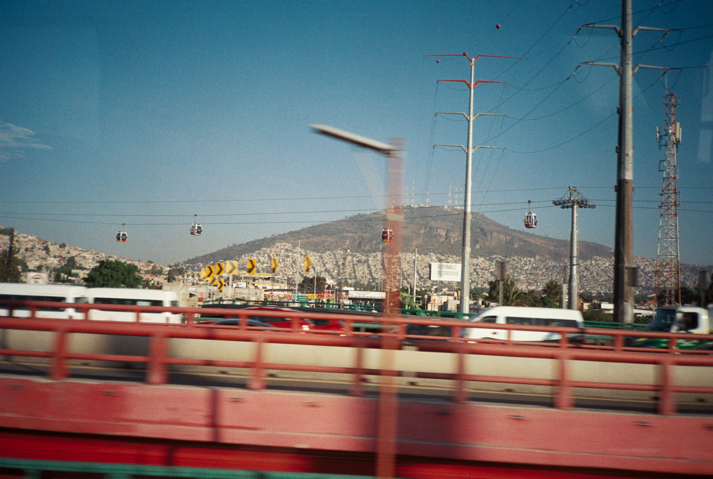
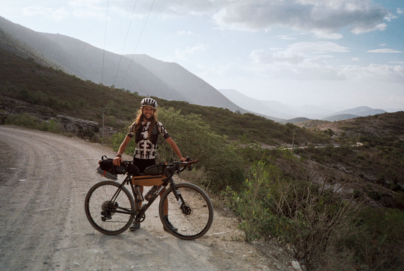
The starting point for this trip is the city of Pachuca, which is easily accessible by autobús from CDMX. Pachuca is the northernmost major city in the Valley of Mexico, but is in the state of Hidalgo.
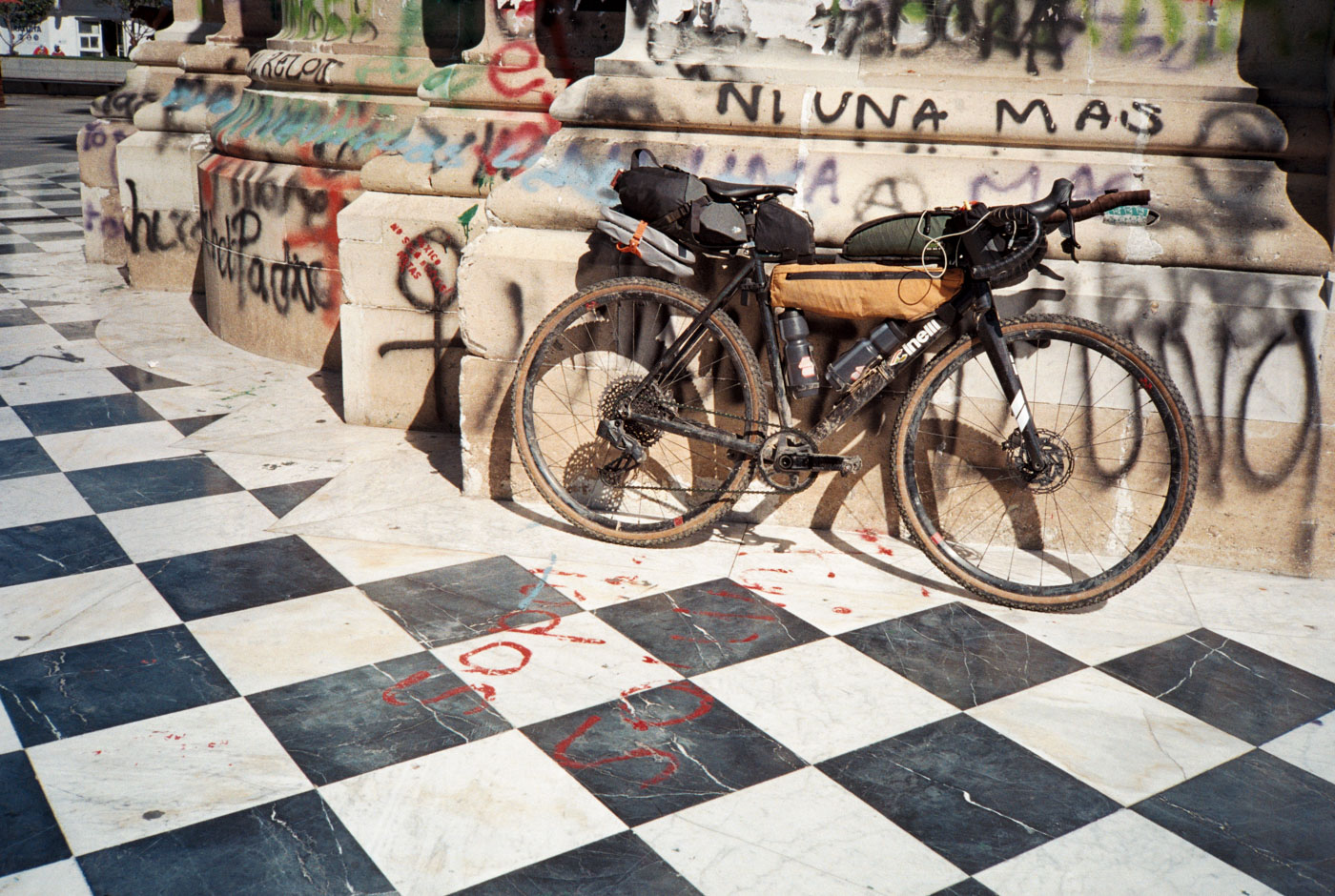
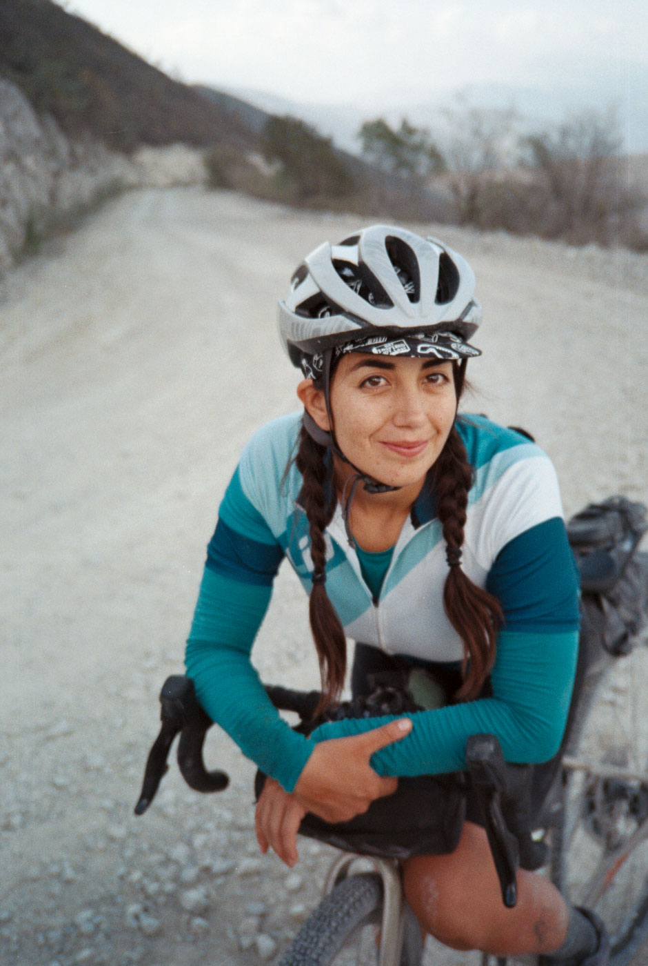
For 2023, i have been riding with Cinelli. This is a very exciting partnership for me, and i am very much so looking forward to where it leads down the road. I’ve been a Columbus steel fan for as many years as i can remember on two wheels. Stay tuned.
This bike is their NEMO Gravel: A light duty Gravel bike with a great balance of nimble handling for technical road riding, but capable enough to cover the rough stuff confidently. A very impressive bike, and uncommon for a production bike to be handmade in Italy! You can read more about my impressions of this bike here, on Cinelli’s blog.
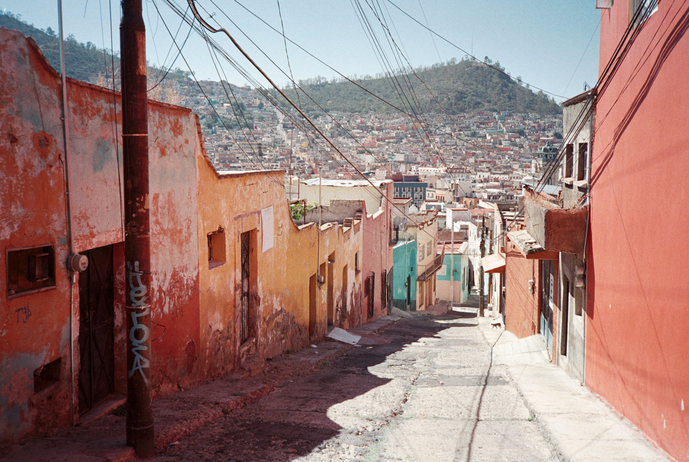
Some cyclists ride to Pachuca from CDMX, as it’s a 180k round trip, however the route is flat, hot, and follows autopista. This never interested me, and i nearly overlooked it. The city itself is quite colorful and hilly, and it serves as one of the gateways to La Sierra Madre Oriental.
GPX Route collection and information can be found here: https://ridewithgps.com/collections/2064581
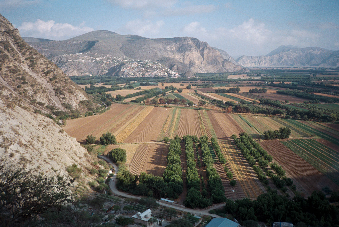
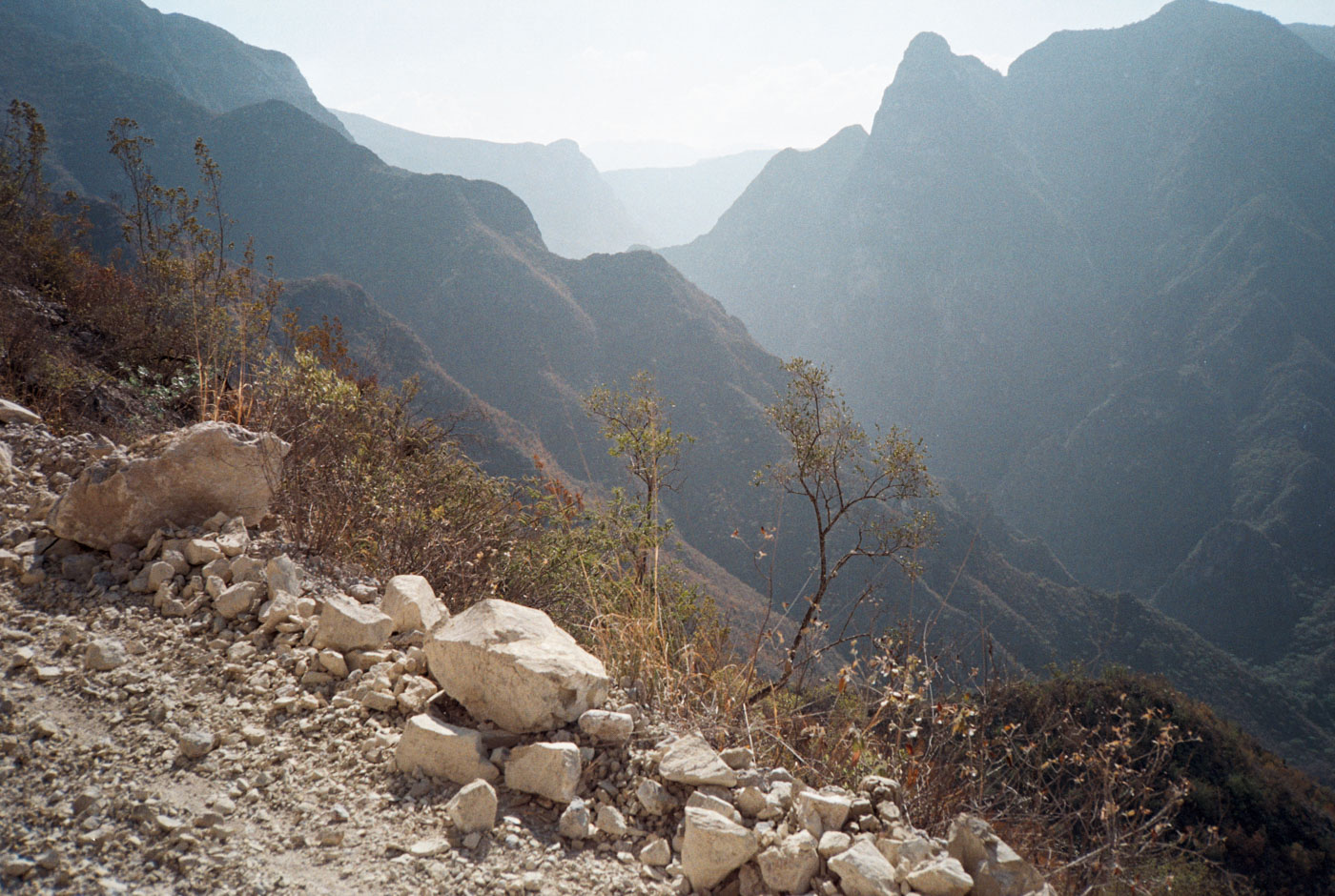
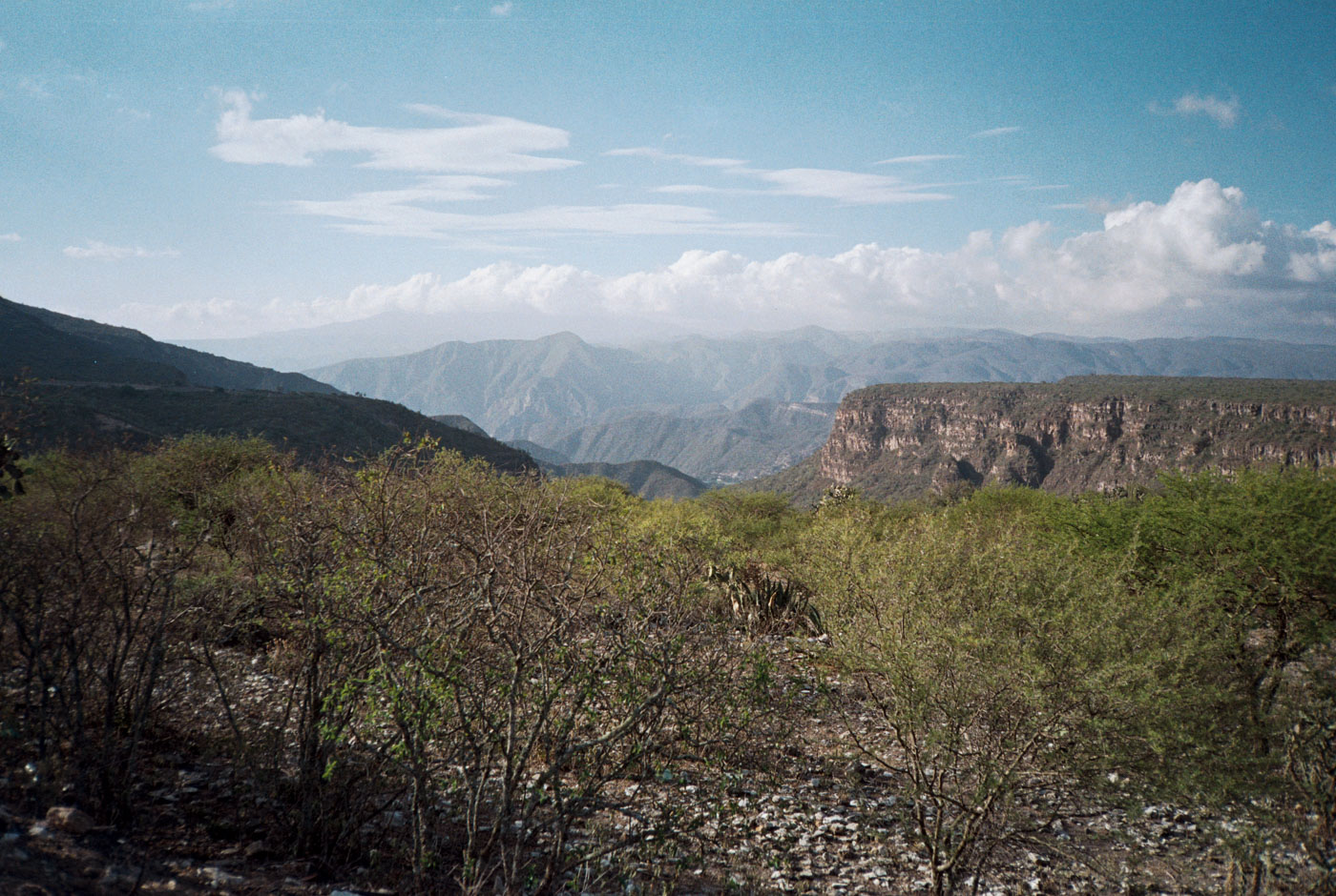
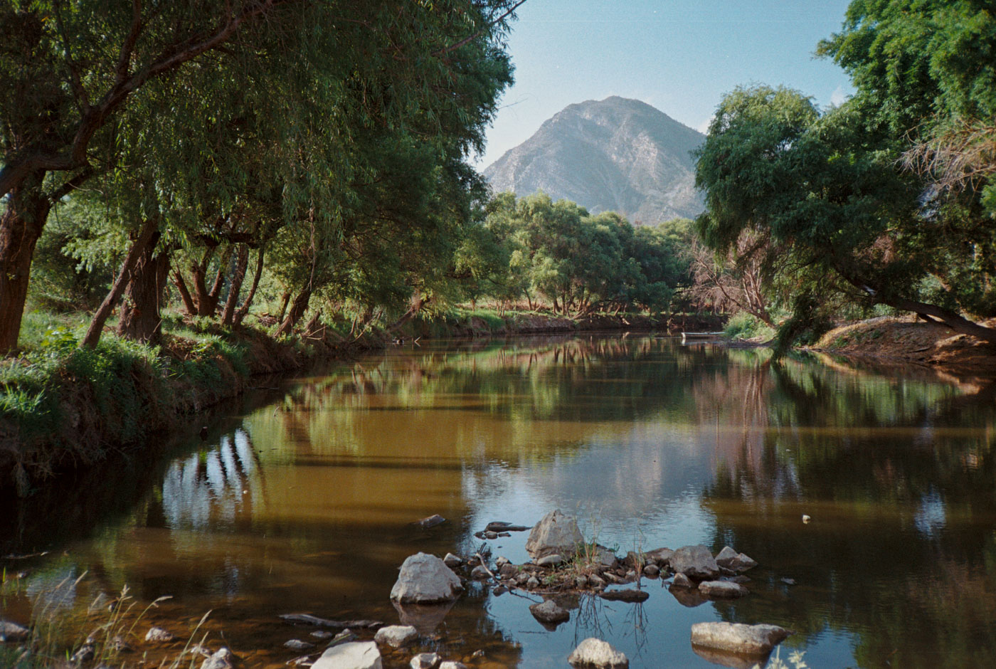
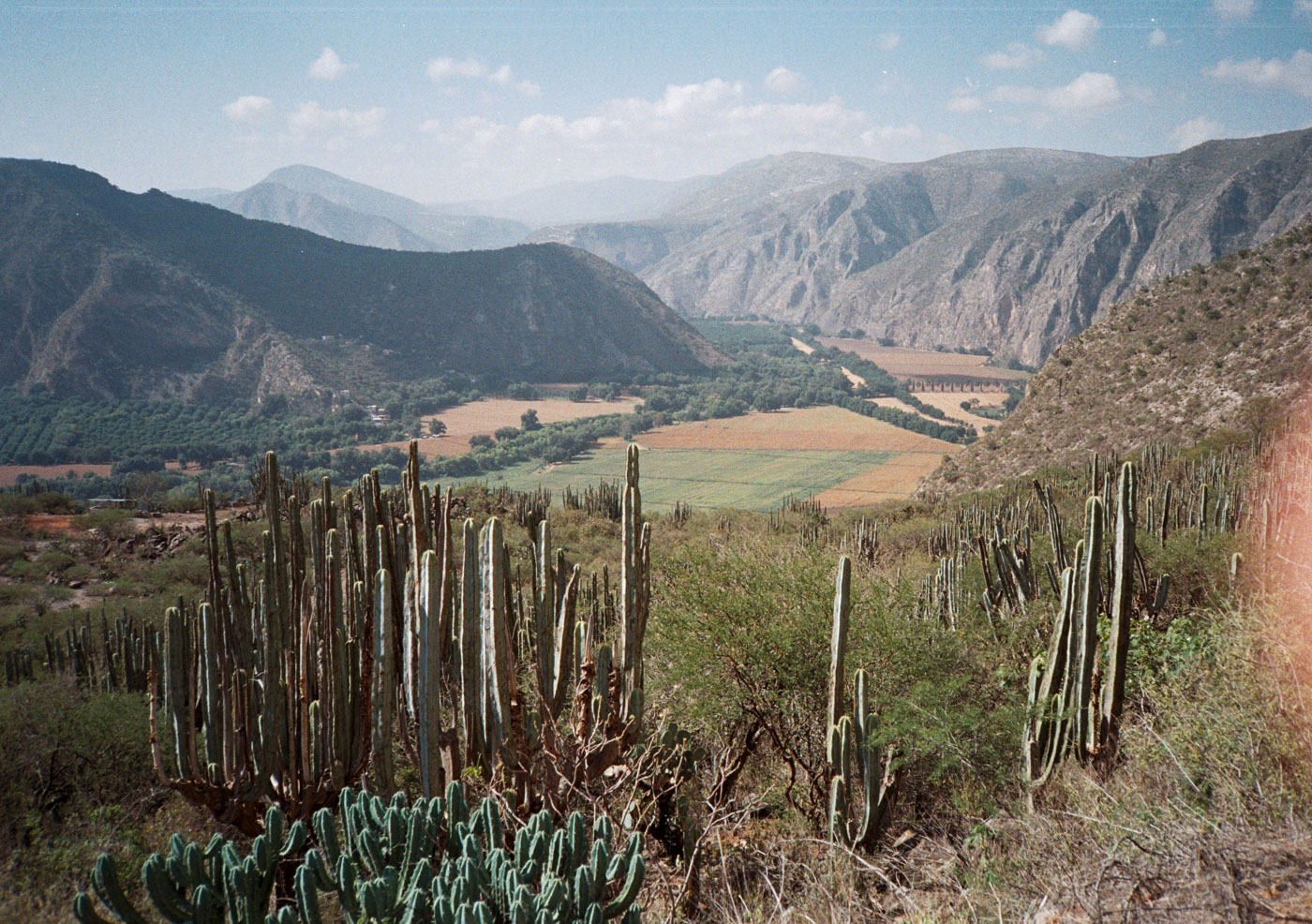
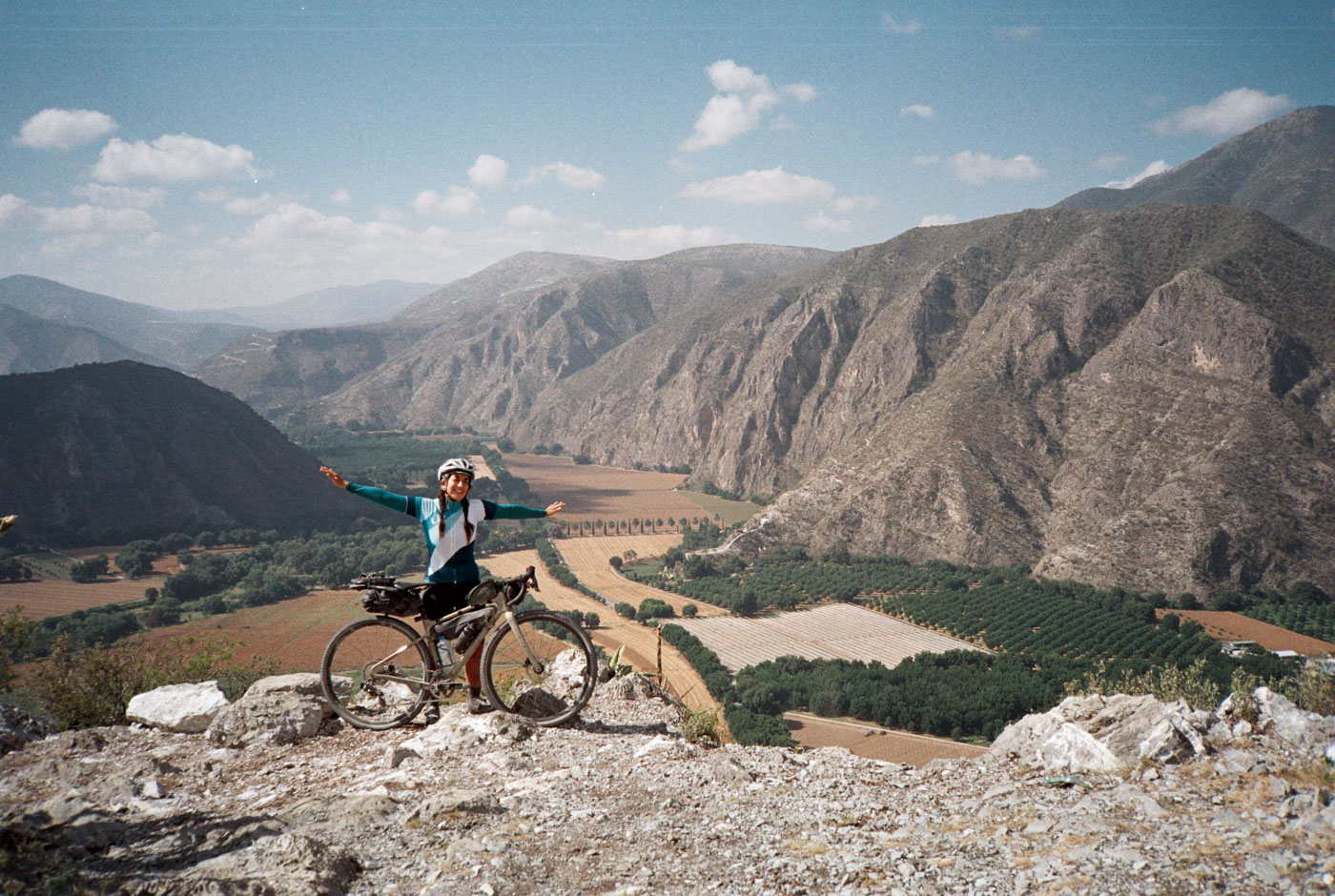
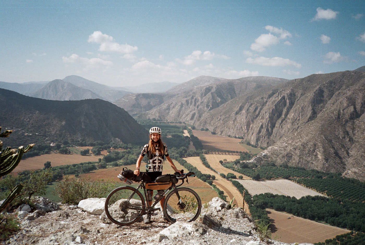
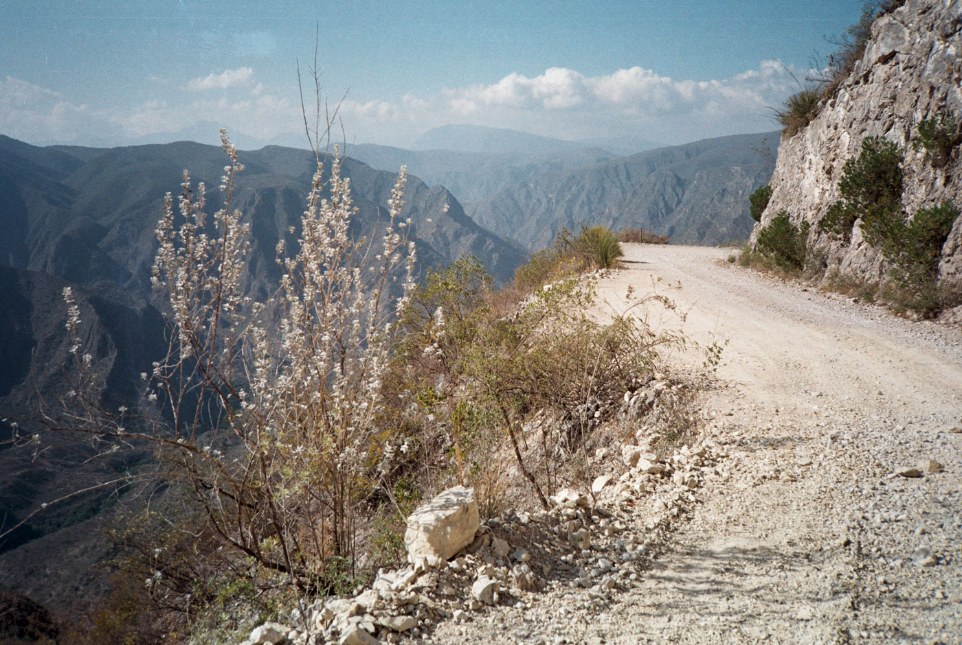
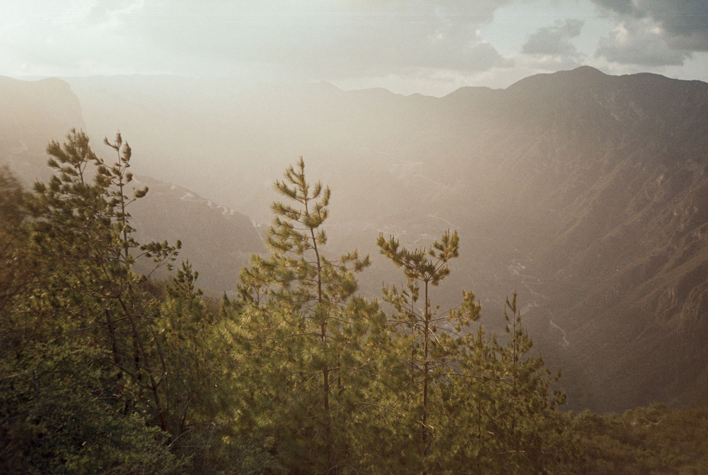
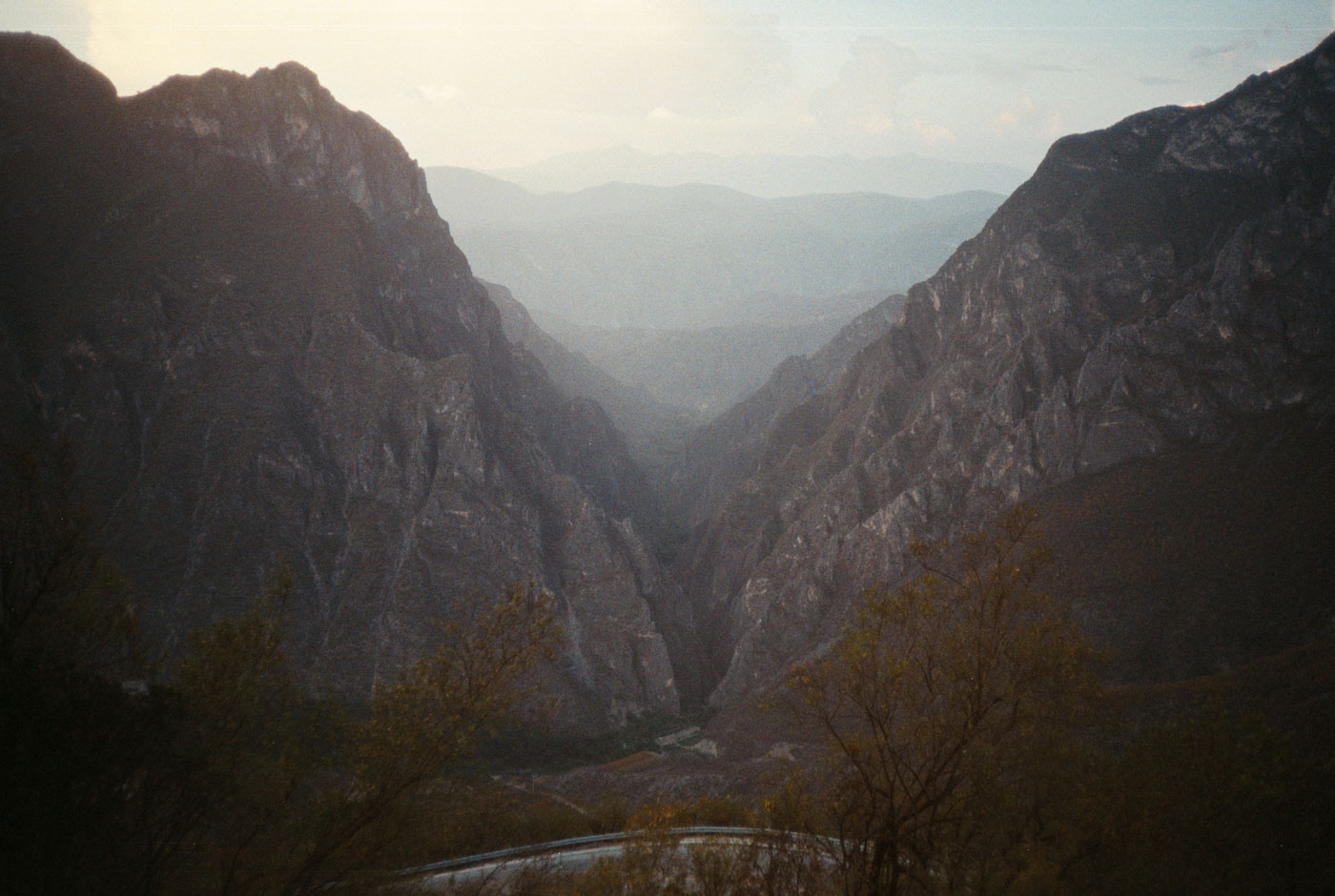
As a first reconnaissance trip, we decided on exploring la Reserva de la Biósfera Barranca de Meztitlán, a large ‘protected’ zone which serves the gateway to the higher regions of La Sierra Madre Oriental. While we both thought Meztitlán was a particular place (which it IS, there’s a pueblo named Meztitlán), the feature is more the entire region. As a gateway to the higher Sierra, as to be expected, it becomes fully mountainous terrain. There is a large central river valley which is flat with many campos, with impossibly steep mountains at its’ edges
There’s a lot of high plateau leading into the zone, and the mountain peaks lead way into river valleys far down below where you imagined the ground was. Simply, a spectacular region that i am elated i was able to visit and now highly recommend.
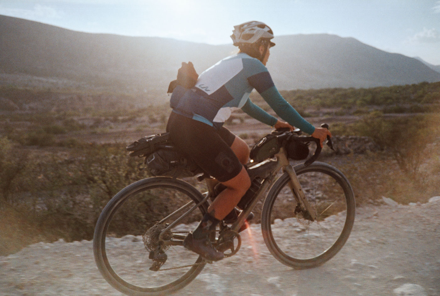
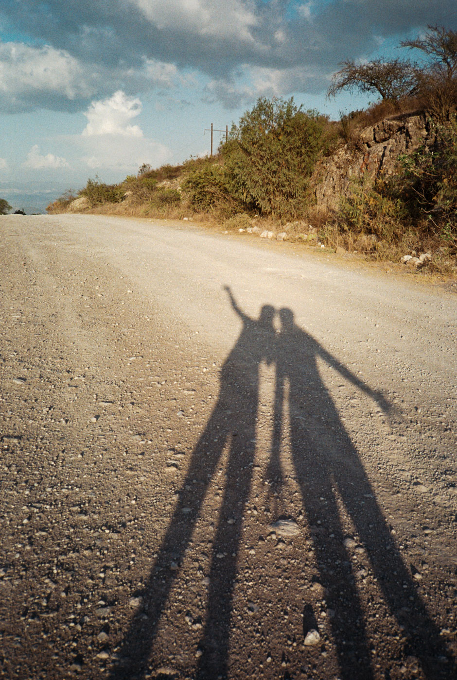
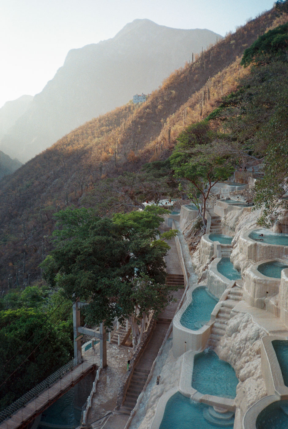
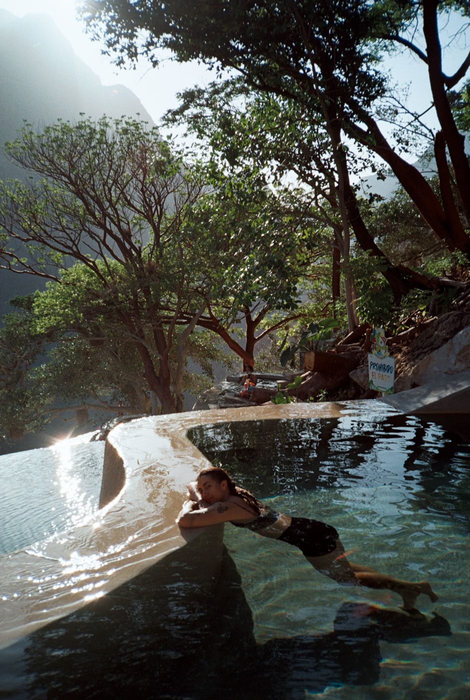
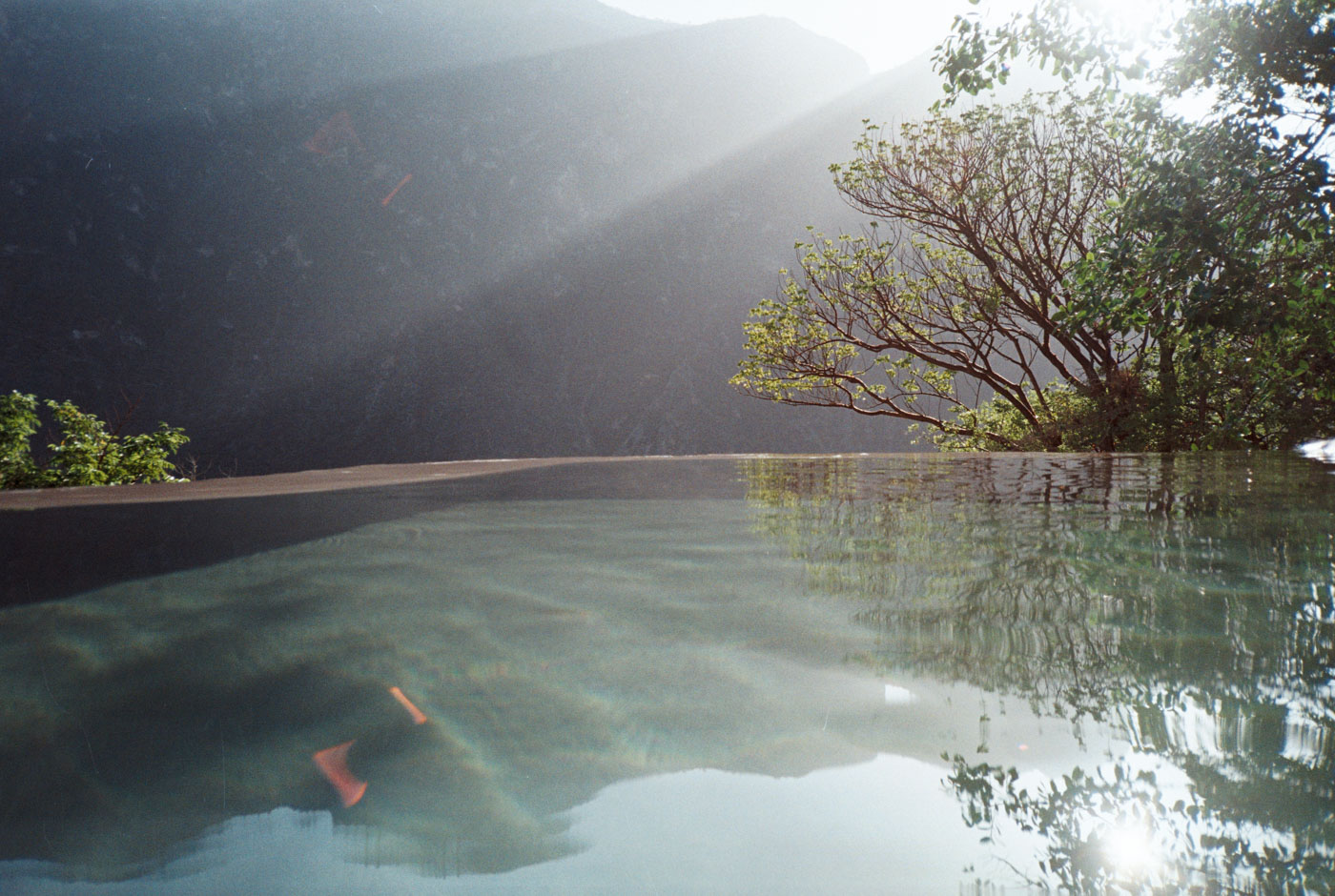
I am coming off of being sick for quite some time now, and Poli is just starting to ride again after getting ACL replacement surgery in January, so we opted to keep our days conservative and have the ‘destination’ be somewhere breathtaking that she has wanted to visit for some time: Tolantongo – an infamous Ejido-turned-resort in the mountains, complete with hot springs and baths built into the side of the mountain. Truly spectacular place… all bike rides should end like that… read through for the photo.
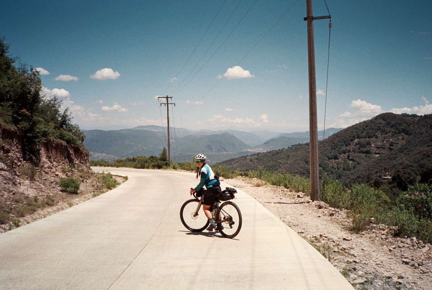
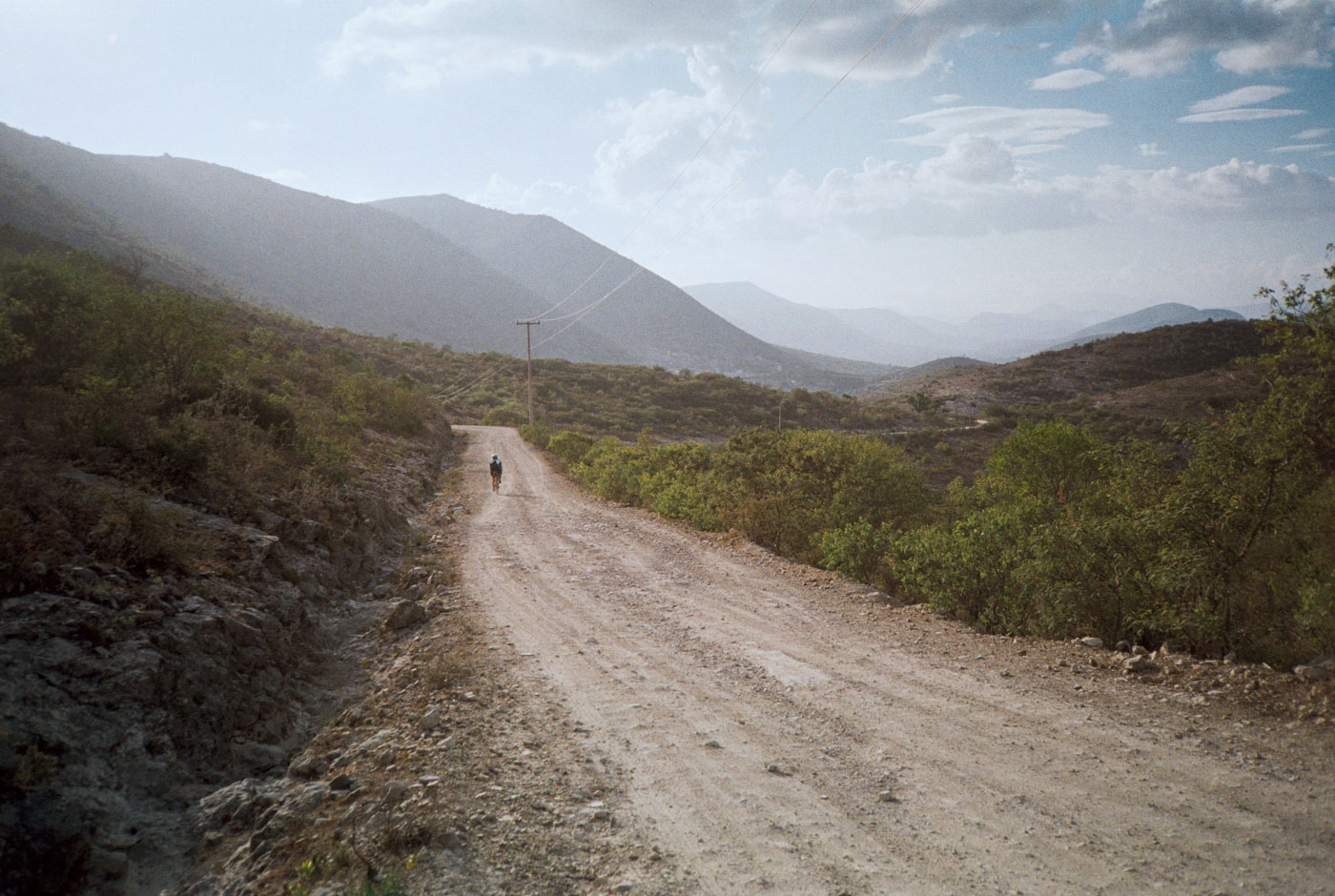
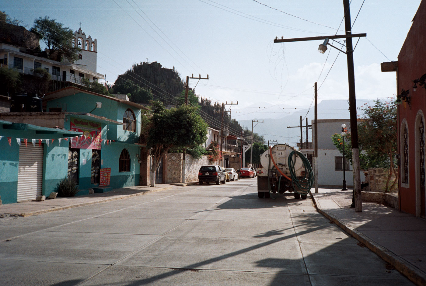
We climb out of the city through an ex-hacienda and pass a mine before reaching small concrete road that leads into bosque (pine forest). We summit at around 10,000 feet before beginning to descend into the lower elevations and more desert conditions. The remote camino is a mix of concrete, stone, or rocky loose gravel and connects with a stone road to el pueblo magico, Mineral de Chico.
<> phone photo
Something that was unique about this route is the gamut of colors of the gravel encountered. Typical grey, dark yellow, white, black volcanic, and even green gravel (that was a first!)
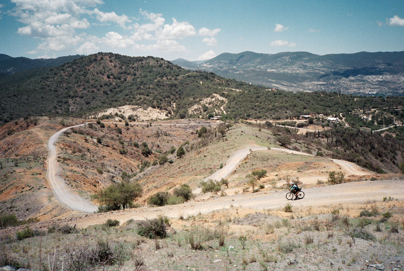
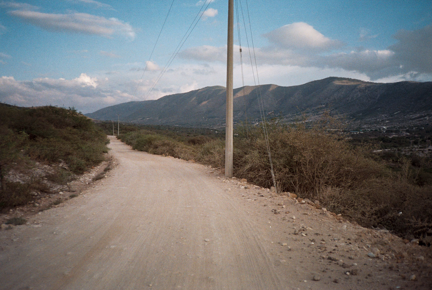
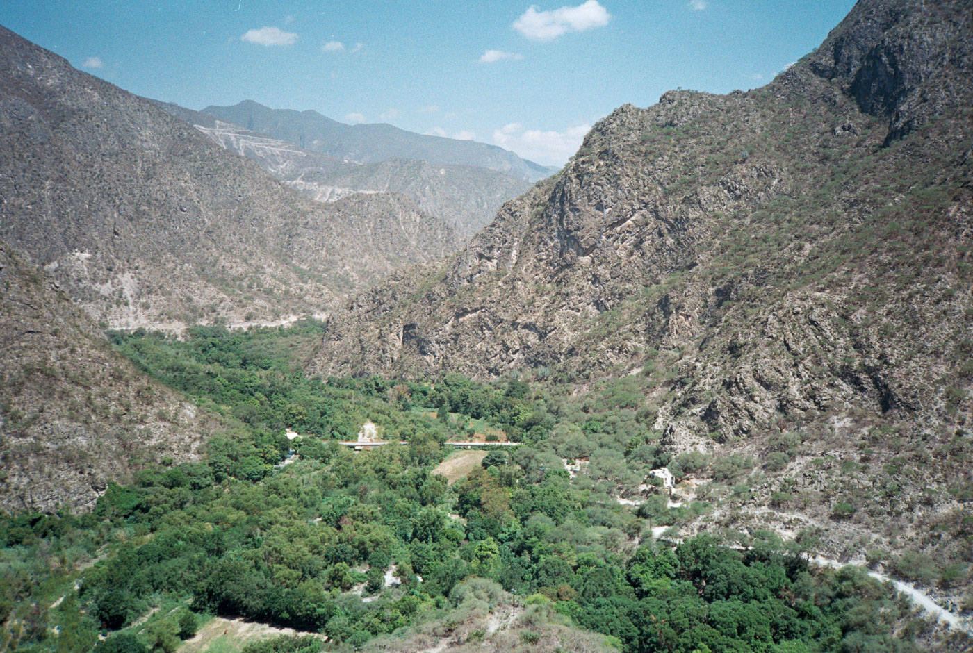
The bottom of the first major climb is Santa María Amajac at the Río Amajac. After there, the route is completely gravel or camino real until Meztitlán.
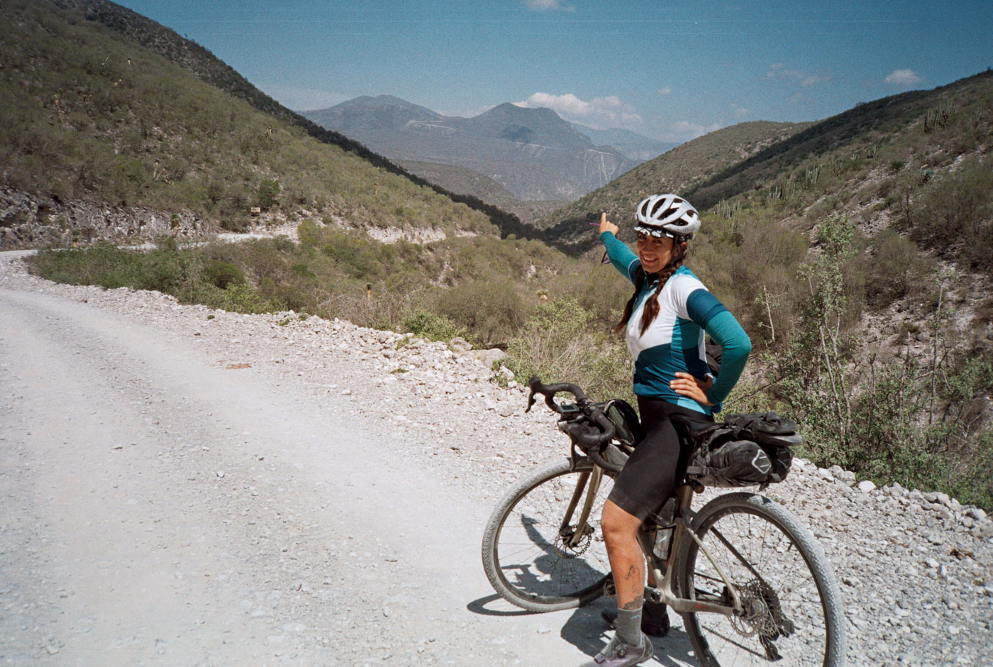
We climb through a desert valley for a couple hours through a few pueblitos before eventually making our way out of the valley to a pueblito named Cerro Colorado – and the closest we get to autopista for the entire trip.
It’s always a point of mine to try to find a route that avoids heavily trafficked roads, especially autopista. I don’t care how long it takes to get somewhere, as long as the route is passable and (mostly) rideable. This freestlyle route turned out to be an incredible track. Im sure many peers of mine who explore and build routes can attest that at some point a route build and try has turned out to be an hours-long hike-a-bike at some point… jaja.
From Cerro Colorado, the track turns to black gravel/horse track and eventually into volcanic rocky singletrack. We weren’t sure we would make it, but the camino indeed went through. What a cool section to arrive to Santa Monica Autempa, before entering el biosfera de Meztitlán
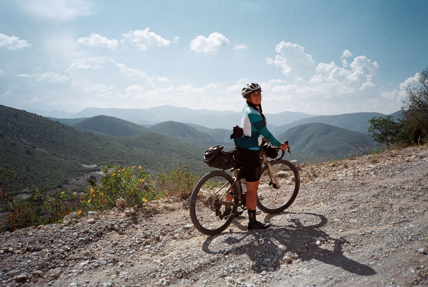
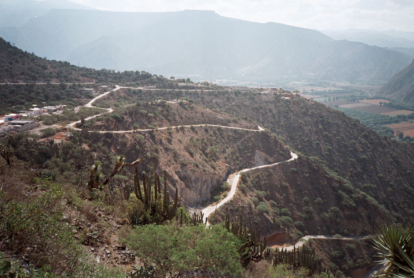
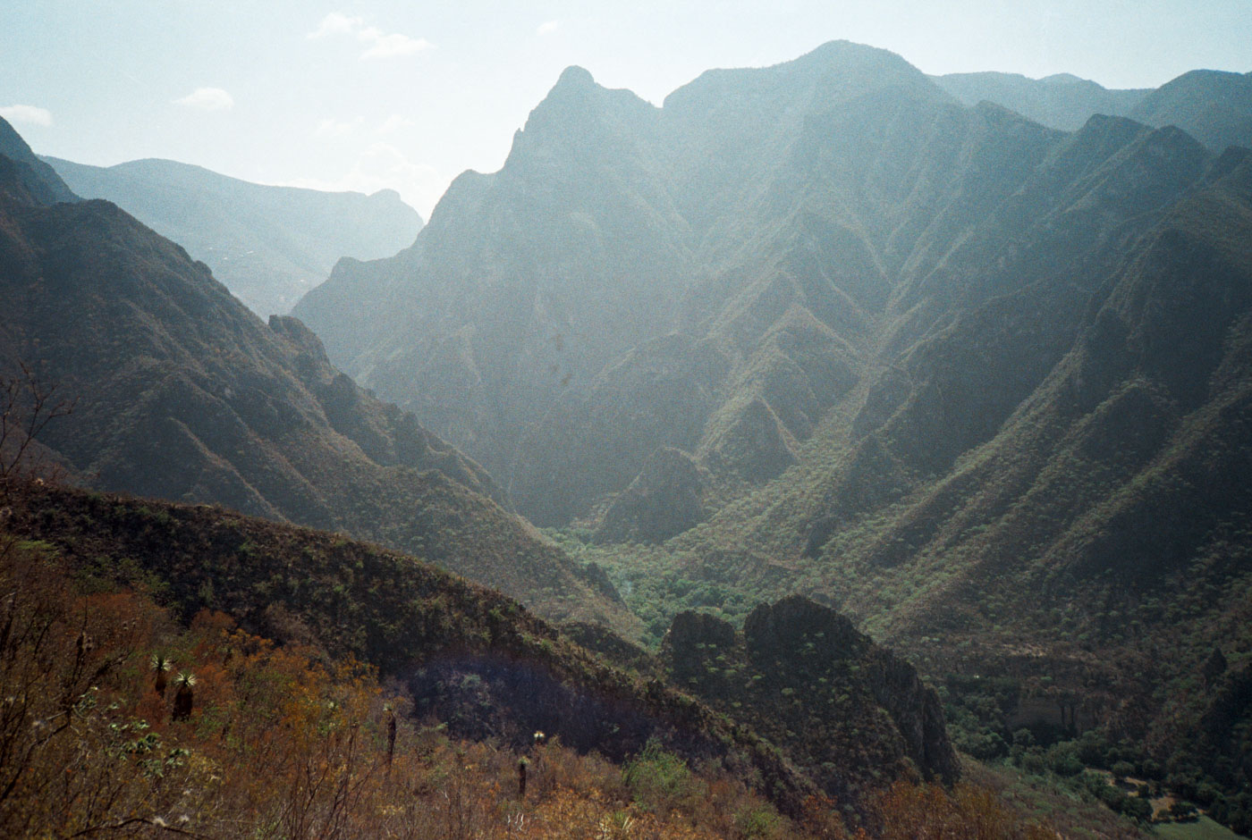
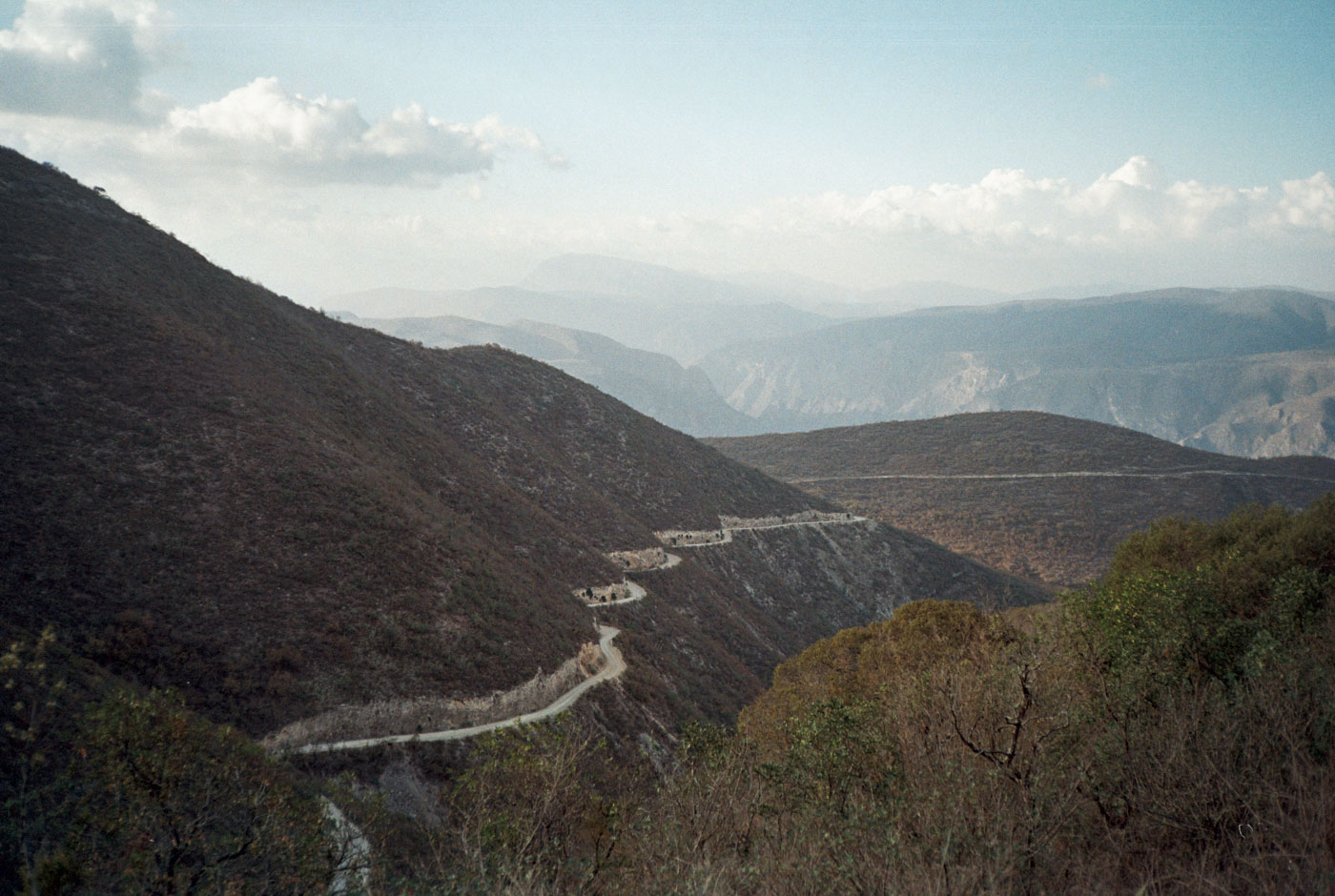
What was seemingly flat, turned out to be a high plateau above La Barranca de Meztítlan. Towering cerros line this valley for at least 20kms. The late afternoon sun was pouring into the valley for the beginning of and nothing but smiles as its a rolling false flat down until we hit the final descent of the day. An impressive valley with this being the only thru road, with only one other access point with dozens of switchbacks.
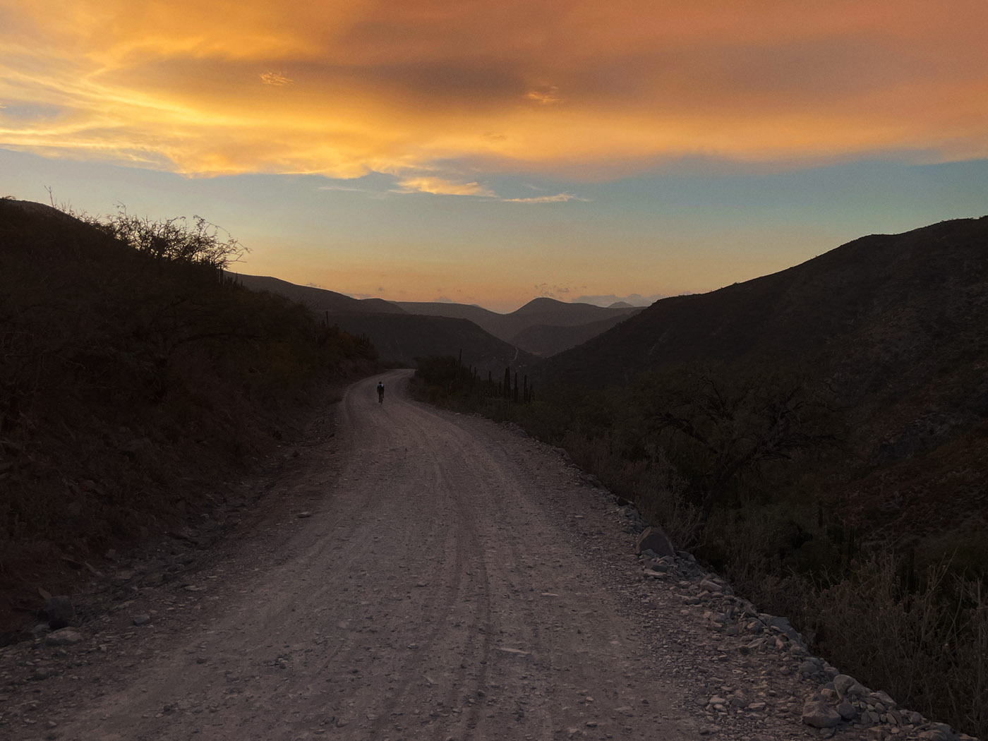
Golden hour eventually arrives right as we approach a steep drop of switchbacks to the main river valley and barranca.
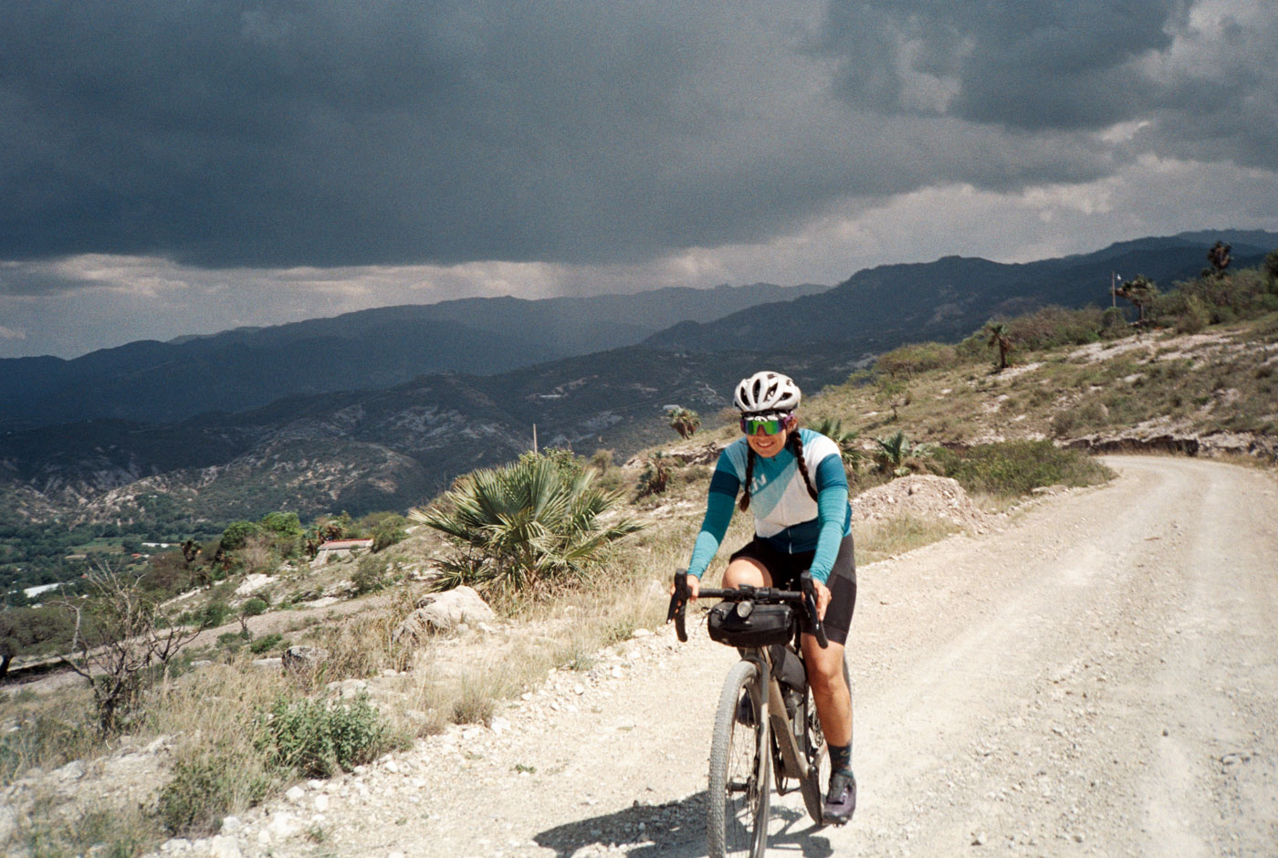
We find ourselves moving slowly and the morning already brought significant heat. I could feel it already, i got zapped from the sun the previous day. Poli and i searched for desayuno, with little to be found other than carnitas (at 8am?!) and a panaderia. Such is la vida de pueblos on a saturday morning. Slow. Simple. We settled for some pan de pueblo and got moving as quickly as we could.
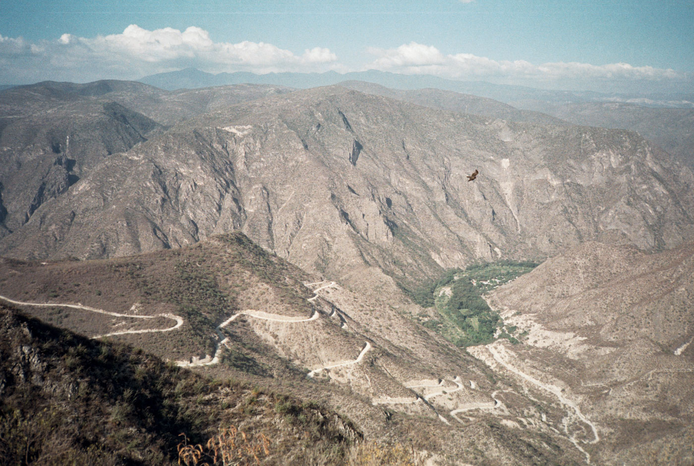
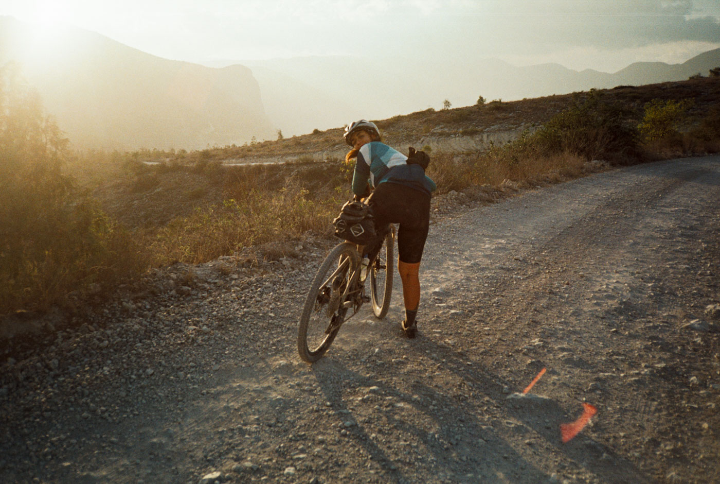
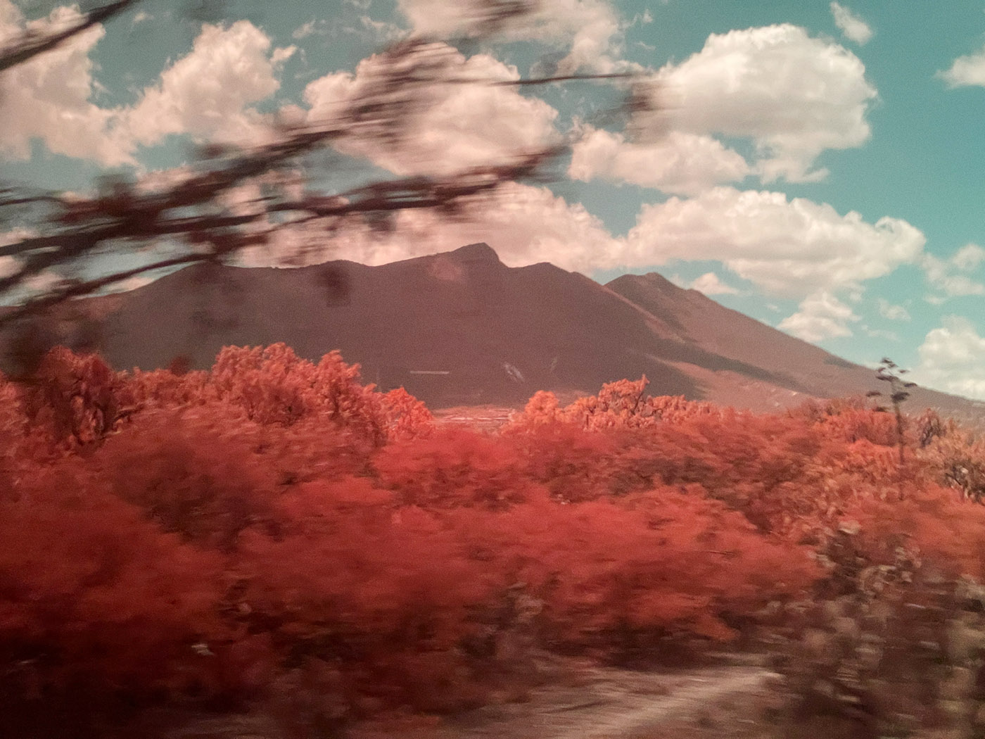
We climb out of San Cristóbal in direct sun, with no shade in sight. We ascend through hundreds and hundreds of Cardon Cacti lining the steep mountainside and along the camino. These are some of the largest cacti in the world. They thrive in the blistering heat – us, not so much.
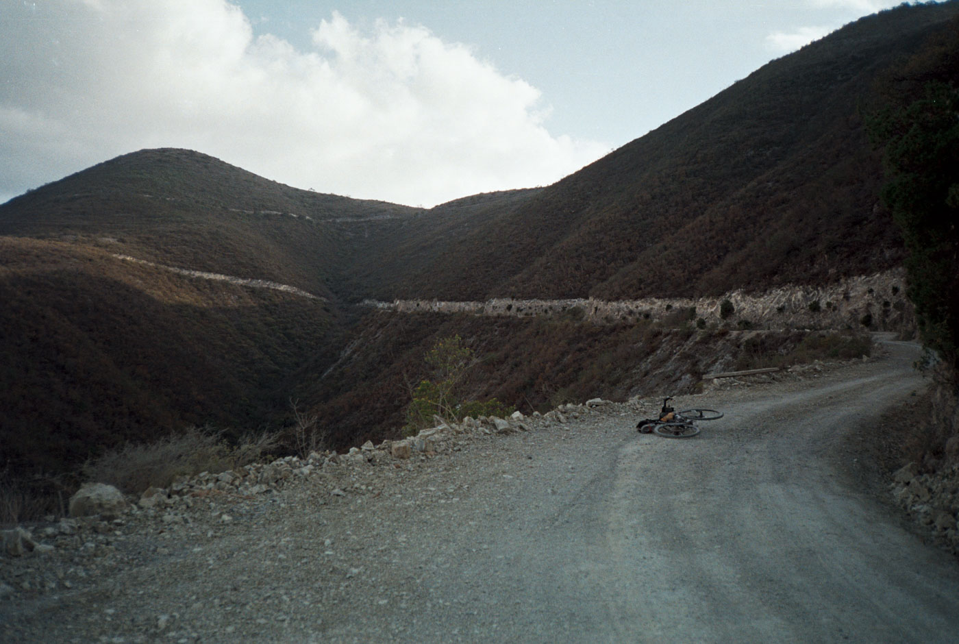
We descend over 2,000 feet down a very winding, rocky pass to arrive back at el rio Amajac, but much further up the river in la Sierra. There are near vertical walls along the entire river. Midday has set in, the worst time to be out in the sun. Pictured top left are the switchbacks we are about to climb for the biggest climb of the day. By the numbers it isnt too bad, but damn, numbers can lie.
We find a tiendita out of someones house (the only house/structure to be found) and take shelter in the shade for an hour or so before making our way a few kms along the river the the base of the climb. Im not sure i would have made it without a break in the shade and fully soaking myself with the hose which was luckily out the back of the house.. seriously i was in bad condition for what was to come.
At this point, the sun was finally low enough behind the mountain to catch some shade and cool the air temperature. There was close to zero shade coverage on this climb, which im ususally ok with, but was a serious problem for me that day. For reference, the surface temp thermometer on my wahoo read a whopping 123*F… a new record. Luckily, there was one structure built for a saint at the juncture to Chalmita about half-way up the climb which i took refuge in the try my best to normalize. Im very glad we planned very humble days.
The first half of the climb in terms of distance and elevation took a brutal four hours. Whereas the second half (same distance and elevation gain) took less than two hours, once the air cooled off slightly. Crazy.
We finally arrive en Tolantongo y Ejido San Cristobal Cardonal. I don’t think this is a very typical way to arrive here.. The barranca pictured above has a hot spring river down below and the road across the Canyon looks spectacular.
Upon arriving at the top of the canyon, we see a small army of tour buses parked that cannot get down the steep canyon. There isn’t really another way to get here other than to drive, but on ruta principal. We saw only a handful of vehicles all day on our dirt route. It is very remote on the other sides of these canyon walls. This barranca is actually quite a popular tourist destination, but for very good reason…
We begin the descent down to las grutas dropping significant elevation on very steep, super tight concrete switchbacks with cars flying. Crazy way to end the day!! (especially after a 6 hour climb)
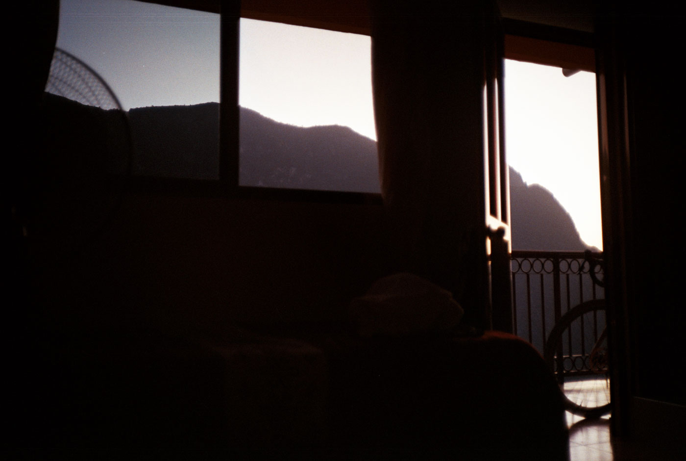
We arrive at the main gate to Las Grutas de Tolantongo just before dark. The attendant tells us the hotels are all completely booked, a bit puzzled that we arrived on bikes. We speak for a few minutes and tell him where we came from. Thankfully, he points to a small house up a hill, just past the gate – a small cabaña with occupancy! This turned out for the better, 1000%. This was a completely family run guesthouse, with only three rooms. The children of the family we’re exceptionally kind and showed us our room. This must be Tolantongo’s best kept secret jaja. Que suerte….
Of course, i wasted no time to use this opportunity to ask questions about their humble valley and the surrounding area and beyond. I spoke with el patron de la cabaña outside about deeper into the Sierra and if i should be cautious about any particular areas. Poli and I had heard rumors of an unfriendly and protective ejido on the north side of the river here. The face of el señor lit up, with a beautiful sense of pride and he kindly reassured me, to my releif, that the pueblos nearby, and all throughout the region in La Sierra de Hidalgo are all friendly and super tranquilo.
For example, the road to cross the river to another pueblo named “La Gloria” has accomodations and is the only other way into this valley from the high plateau of the valley of Mexico – here the map does not go through. We might have arrived this way, but had no way to know if passage was possible. There are three ejidos next to each other, all wanting a piece of the natural resources. Una niña joven overheard my regional questions in my functional, but sub-par spanish, was super kind, speaking to me and to my surprise spoke perfect english – a first for me in a pueblo.. but i suppose this is a tourist area, so i shouldn’t be so surprised. Still, as usual, i was almost the only güero in the whole valley – as usual.
Two important navigational points:
1. We continued our conversation and mentioned to me that there is a bridge and you can pass the road, from La Gloria to Tolantongo, but need to pay $150 pesos. Excellent.
2. More importantly, i asked about the northern side of the canyon and the incredible road that climbs out the impossibly steep other side. This is a crucial connection to continue further north, and opens up a lot of routing opportunity to continue along el Rio Amajac and beyond. That side was the rumor of a closed bridge and an ejido that would not let you pass (as well as this road not on google maps). To my delight, I was told there is no problem to pass, climb up and continue further, and even go all the way down to the river on that side on hiking trails. Very cool. always speak with locals!
Las Grutas de Tolantongo
The best for last – this place certainly lives up to it’s hype. Here are a few photographs of las pozas.
Traveling back to CDMX
We initially had two routes for day 3 to return to Actopan, and then catch an autobús back to CDMX. There was a very trial and error route, which actually followed el rio Amajac south, without a camino or sendero. This means that it could be an epic hike a bike if the river was flowing. It wasn’t all too far and our friends Bane and Dinno had ridden part of it recently, from the other direction. The problem was the enourmous 4,000ft + climb to leave the river valley, which we really just weren’t up for… jaja. So, the plan all along was to have a route B – an easier route back to Actopan from Tolantongo without going to to the river.
To our delight, and the end of our second day upon arriving to the top of the canyon, we found out there was a Microbús route. Amazing. This would take us to another city, named Ixquimilpan, which also had an Autobús back to CDMX.
We mutually decided on the micro (an adventure in iteself, sheesh) and to take a well needed rest day instead of another ride. Flexible and effective plan. Now we know.
a note on navigation and safety
Sometimes there really isn’t another way to know, except to go, and figure it out. More often than not though in mexico, you do not want to explore somewhere you are unfamiliar with, as things are exceptionally dangerous in Mexico. Sadly i’ve also experienced first hand… and heard far too many personal accounts from friends here. Some people like to be ignorant to the dangers that exist here, but i value my life and would like to continue riding for many, many decades to come.
Thankfully, the state of Hidalgo is safer than many other states in Mexico, which is a serious relief. Do not delude yourself though, you must maintain vigilance 100% of the time here. However, it is a huge win to begin to explore somewhere i feel safer. The areas surrounding CDMX are really quite dangerous, especially near the border of other states (which also happen to be the best places to ride). Honeslty, i’ve been terrified to ride solo, or even later in the afternoon in the places i like to explore around the city, so this is exciting.
<> photo of me in Pachuca
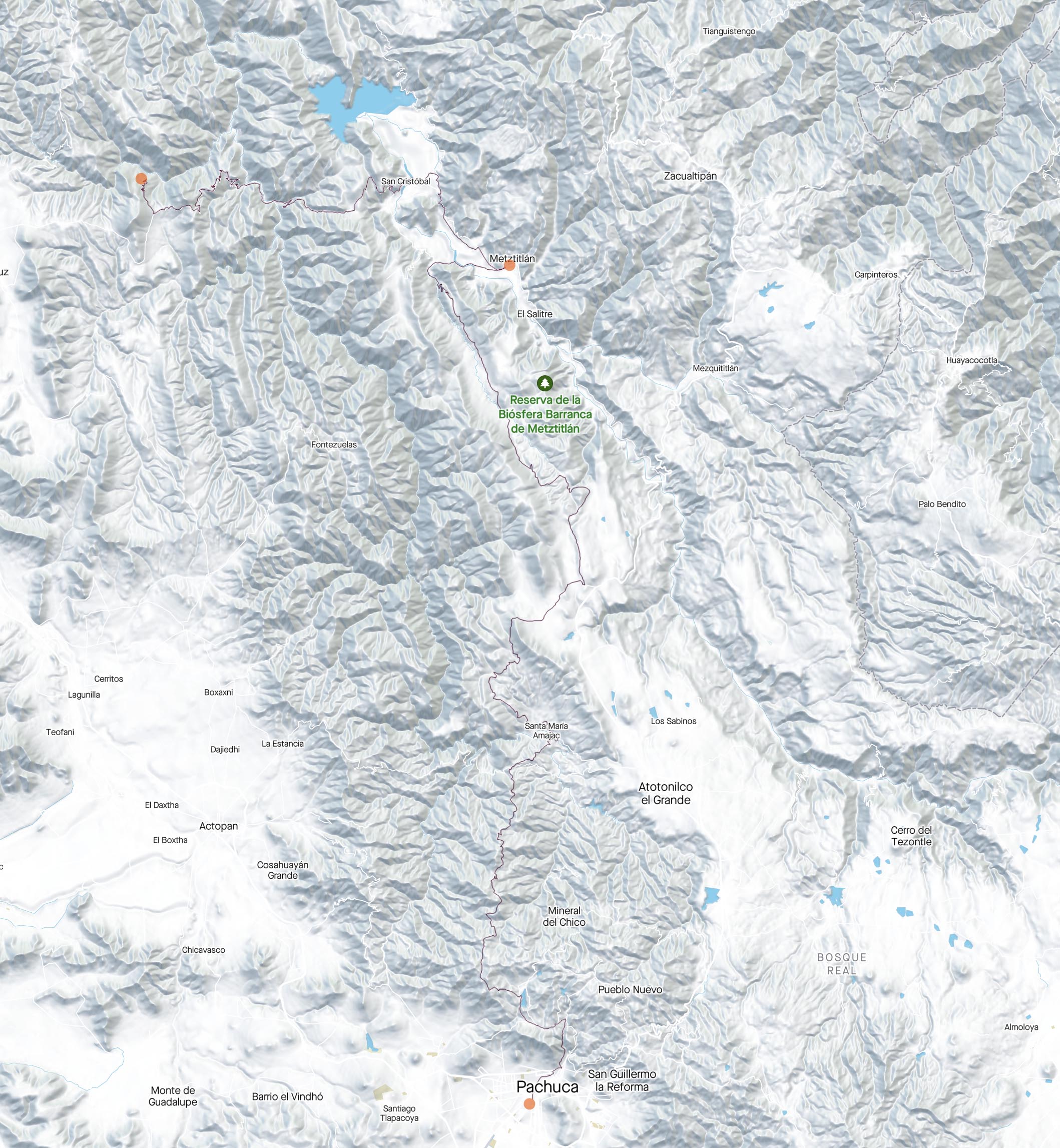
Here is a screen grab of heat maps and lots of untraveled/untracked caminos en la sierra north of Tolantongo y Laguna Meztitlán. As you can see, there is not much to rely on in terms of people actively riding here, or recording gps tracks. Gotta go and find out for ourselves – and now we have the perfect jump off and first stop (maybe for more than a day :P) for a spectacular bikepacking voyage.
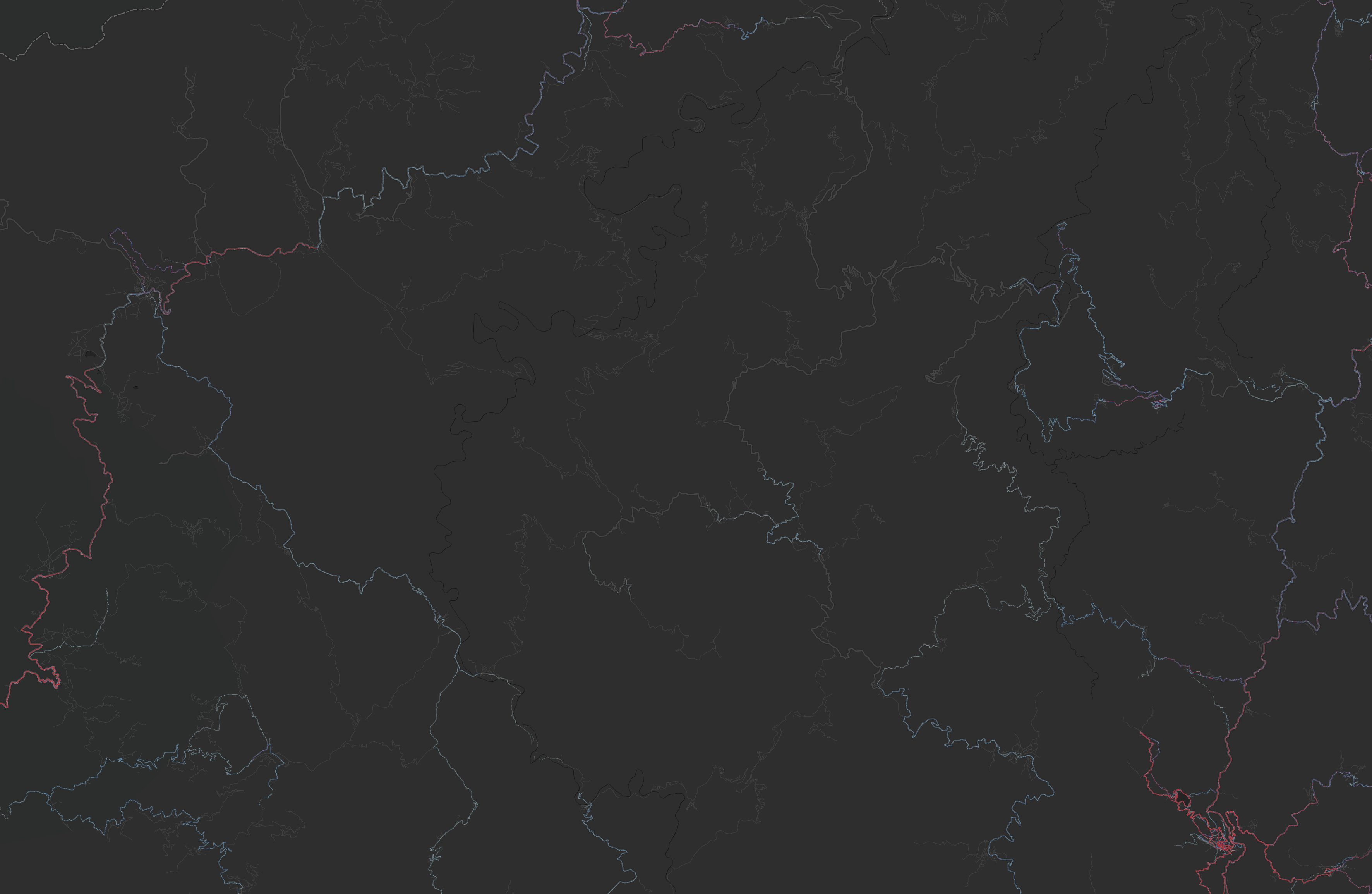
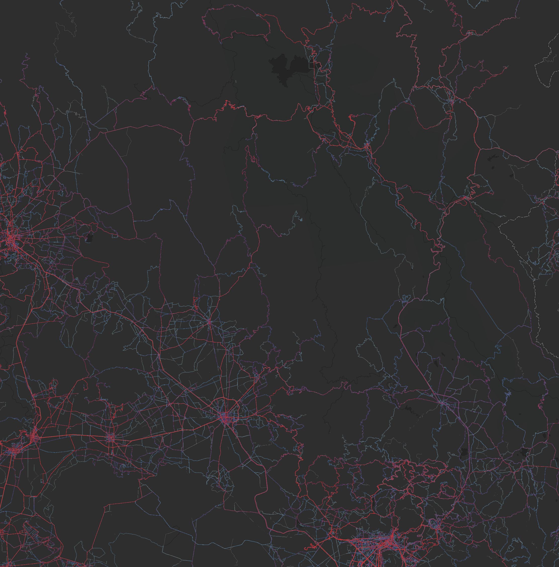
left to right bottom diagonally are los ciudades Ixquimilpan, Actopan, and Pachuca
Anyways, i am excited to report this trip was the key to the next adventure here, so mission accomplished. What a spectacular experience for such a short amount of time and distance. Don’t ever underestimate La Sierra!
until next time. expect more documentation like this as adventures progress here in Mexico. Hasta Luego Amigues